

Photo: Oregonlive.com
Last winter we started hearing things about a plan to move Union Pacific’s Albina Yard from its location on the bank of the Willamette below the Overlook neighborhood and redevelop the property for urban uses. Last month, we finally caught up with Mohammed Baddredine, the visionary behind the initiative. We were really excited about this and decided to take Mo’s work as a starting point for some visualizations of how an urban neighborhood could develop here. We drew inspiration from the new urban districts we’ve visited in northern Europe where obsolete port facilities from Manchester to Rotterdam to Malmö have been reclaimed as vibrant neighborhoods.

Isberjet, Aarhus, Denmark

Västra Hamnen District, Malmö, Sweden
Our concept starts starts with a grid of 200 by 200 foot blocks, following the pattern of downtown Portland.
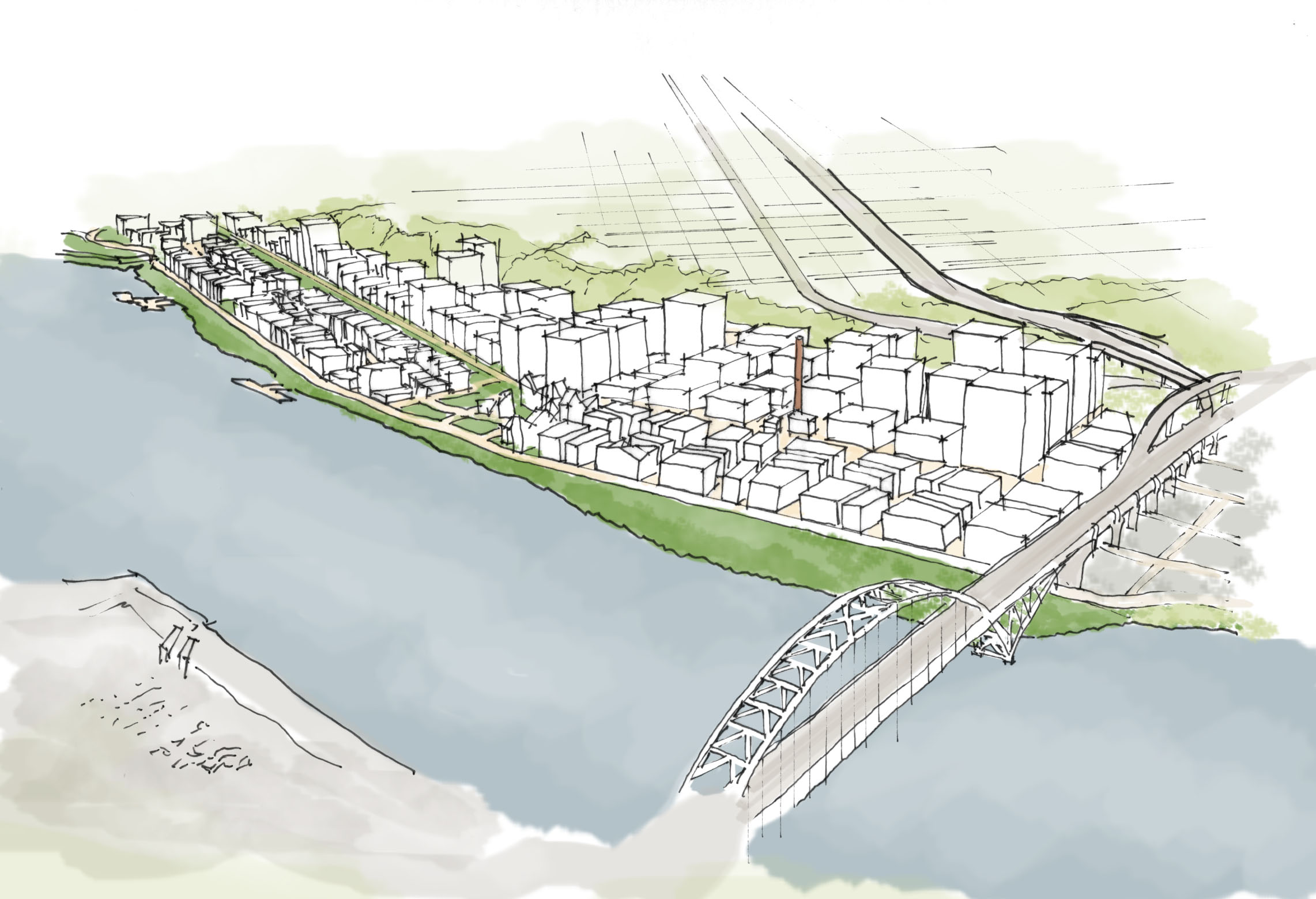
Looking north from the Fremont Bridge
In order to improve circulation, we propose adding a new bridge - we suggest dedicating it to the late Portland author, Ursula K. Leguin. It would cross to the north of the Terminal 4 site, which has been proposed as the site for a Major League Baseball park.
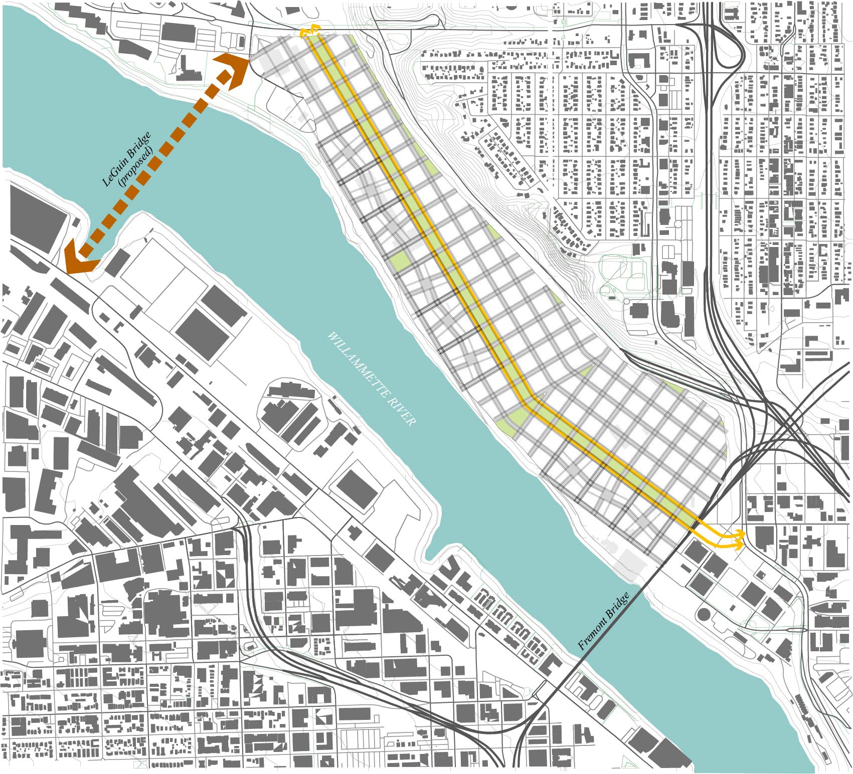
General Site Plan

Looking south over the Overlook neighborhood, Terminal 4 at upper right
We created over seven acres of new parks within the site, in addition to upgrading the Willamette river bank for more useable open space and habitat. The centerpiece is a spine of park blocks that runs the length of the site. Additional plazas and parks are provided including one dedicated to a new K-6 elementary school.

Park & Open Space Concept

Proposed neighborhood school

Looking south toward downtown, park blocks in the foreground
A spur line of the Max Yellow Line would run along either side of the park blocks, adding three new stops. All portions of the site would be within a quarter mile of a stop. This 1.3 mile line could potentially extend an extra 3/4 mile north to serve Swan Island, which is a major employment center.

Light Rail and Stations with quarter mile catchment areas
We located primarily residential blocks closest to the river. These blocks would allow limited commercial uses but would consist mainly of homes. The rest of the northern portion would be mixed use with a focus on employment; office and light industry/fabrication. Housing and hotels would be permitted here. The southern commercial area would have a similar profile, but would allow much more intensive development.

Land Use Concept
These proposed patterns are reflected in the district’s height limits. These limits are also designed to avoid disrupting views of the river and Forest Park from the plateau above.

Height Limits
Residential areas deserve special attention, creating blocks that foster slow movement, pedestrian circulation and public spaces conducive to social interaction.

Residential Block Concept
Finally, we feel it’s important to preserve and showcase the iconic chimney, a landmark and testimonial to the area’s 19th century industrial past.
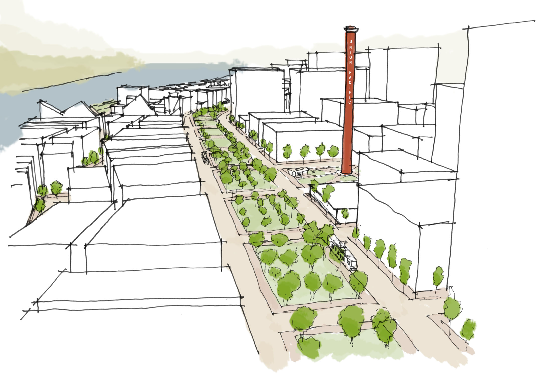
Facing north, with preserved Union Pacific chimney
Here’s our model, by the numbers:
